Trail On foot La Valla-en-Gier - 10712852-la Valla en Gier - Photo
© OpenStreetMap contributors
Length
Length
17.3 km
Max alt
Max alt
1020 m
Uphill gradient
Uphill gradient
797 m
Km-Effort
Km-Effort  
28 km
Min alt
Min alt
528 m
Downhill gradient
Downhill gradient
797 m
Boucle
Boucle
Yes
Creation date :
2020-05-31 06:06:38.484
Updated on :
2021-10-02 08:45:16.597

(0 Reviews)

On foot
On foot
6h30
Difficulty : Difficult

Scan this QR Code to open this trail in the SityTrail application

FREE GPS app for hiking

Logo SityTrail SityTrail

IGN / Geographical institutes

Download SityTrail from the App Store Download SityTrail from Google Play

Logo SityTrail SityTrail World

The world is yours!

Download SityTrail from the App Store Download SityTrail from Google Play Download SityTrail on Huawei AppGallery

About

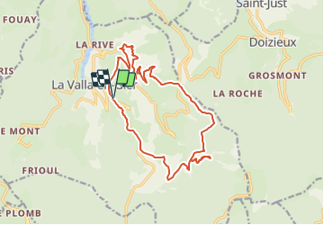
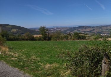
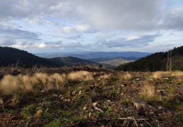
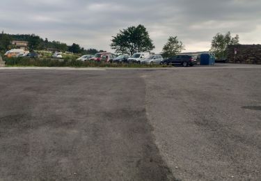
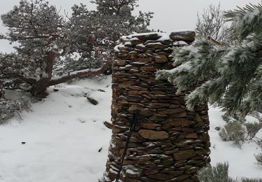
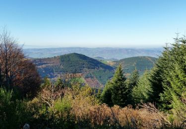
Trail On foot of 17.3 km to be discovered at Auvergne-Rhône-Alpes, Loire, La Valla-en-Gier. This trail is proposed by chanac les mines.

Description

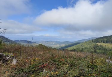
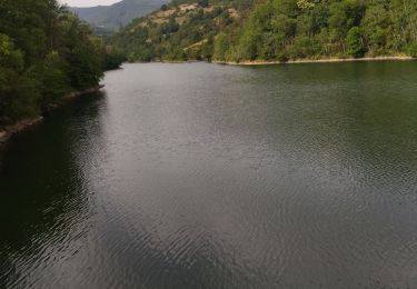
Très beau paysage, en passant par le barrage du Piney pour arriver à la Croix du Planil, belle ascension !! ensuite prendre une grande descente  pour se diriger sur le saut du Gier, passages dangereux et délicats !!! personnes sensibles s'abstenir de monter à la cascade !!!! si non superbe randonnée.

Elevation profile

Positioning

Country:
France
Region :
Auvergne-Rhône-Alpes
Department/Province :
Loire
Municipality :
La Valla-en-Gier
Location:
Unknown
Start:(UTM)
619224 ; 5029875 (31T) N.

Trails nearby

Trail Walking Doizieux - chemin des crêtes de la jassiere - Photo
Walking
olivier26

Walking

Easy
(2)
Doizieux, Auvergne-Rhône-Alpes, Loire, France
12.4 km | 18.3 km-effort
3h 36min
Yes
Trail Cycle Saint-Chamond - samedi 13 août 22 - Photo
Cycle
ocharra

Cycle

Medium
(1)
Saint-Chamond, Auvergne-Rhône-Alpes, Loire, France
60 km | 73 km-effort
Unknown
Yes
Trail Walking La Valla-en-Gier - 24 juillet 2021 la valla en gier - Photo
Walking
Parodie69

Walking

Very difficult
La Valla-en-Gier, Auvergne-Rhône-Alpes, Loire, France
24 km | 40 km-effort
7h 13min
Yes
Trail Walking La Valla-en-Gier - Le Chirat Le Bâcha. Rosillol  La Rivoire. - Photo
Walking
psesjs

Walking

Medium
La Valla-en-Gier, Auvergne-Rhône-Alpes, Loire, France
11.6 km | 19.1 km-effort
2h 44min
Yes
Trail Walking Le Bessat - Le bessat 2013 - Photo
Walking
grfamily

Walking

Very easy
(1)
Le Bessat, Auvergne-Rhône-Alpes, Loire, France
19.3 km | 31 km-effort
6h 24min
Yes
Trail Walking Graix - Le saut du Gier - Photo
Walking
boothcs

Walking

Difficult
(1)
Graix, Auvergne-Rhône-Alpes, Loire, France
13.4 km | 22 km-effort
Unknown
Yes
Trail Walking La Valla-en-Gier - 42 valla en giers - Photo
Walking
randodyssée

Walking

Easy
La Valla-en-Gier, Auvergne-Rhône-Alpes, Loire, France
9.3 km | 14.5 km-effort
3h 43min
No
Trail Walking La Valla-en-Gier - la Valla en Gier 42 - Photo
Walking
cousam

Walking

Easy
La Valla-en-Gier, Auvergne-Rhône-Alpes, Loire, France
10 km | 13.2 km-effort
3h 32min
Yes
Trail Walking Le Bessat - La Scie Du Bost - Photo
Walking
dudu42

Walking

Very difficult
Le Bessat, Auvergne-Rhône-Alpes, Loire, France
15.9 km | 26 km-effort
4h 58min
No


Close
My subscriptions